24/7 Hour
-
-
-
Delhi • Gurugram • Ahmedabad
24/7 Hour
Delhi • Gurugram • Ahmedabad
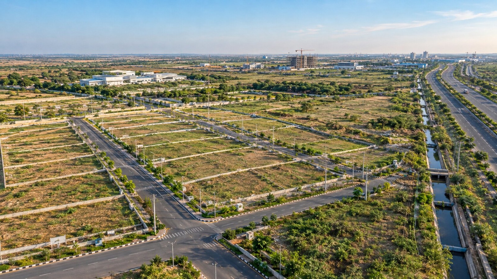
Plot in Dholera Smart City can suit investors seeking long-term exposure to Dholera's planned development. Before buying, check the dholera smart city location, TP scheme, land title, approvals, road access, infrastructure, and development status. Dholera SIR covers 920 sq. km., while its 22.54 sq. km. Activation Area has trunk infrastructure in place.
You may be searching for a Plot in Dholera Smart City because of the region's expanding infrastructure and industrial development.
The difficult part is knowing whether the property you are considering actually matches the location and development claims being promoted. A low price can look attractive, but the survey number, TP status, road access, documents, and surrounding infrastructure matter just as much.
The dholera smart city location also needs careful checking because Dholera covers a large planned development region. This guide helps you understand what to check before buying a dholera smart city plot in 2026. It covers location, Dholera SIR, TP schemes, documentation, infrastructure, dholera property rates, and site verification. The aim is straightforward: help you compare properties using facts rather than relying only on brochures, advertisements, or sales claims.
Written by Deepak Chhabra, founder of Vishall Landbase, with 26+ years of experience across real estate and land development.
Before buying a dholera smart city plot, verify its exact location, planning status, documents, infrastructure, and access. Dholera is a large planned development region. Therefore, the name “Dholera” alone does not tell you enough about a property's investment position.
Start with the village name, survey number, plot number, road access, and applicable Town Planning scheme. Then compare these details with available government records, approved layouts, and project documents.
For example, a property advertised as "near Dholera SIR" may not have the same location advantage as a plot inside the planned development area.
Official NICDC information places Dholera SIR across 920 sq. km. The Activation Area covers 22.54 sq. km. and has trunk infrastructure in place. That scale makes exact location one of the first checks for any investor.
The dholera smart city location can affect road connectivity, surrounding development, planning status, and future usability. A map pin gives you a starting point, but it does not tell the complete story. Check nearby roads, utilities, construction, land use, and access to important infrastructure. Imagine two plots have the same size and similar prices. One has developed road access and visible infrastructure nearby.
The second plot may have fewer developed facilities around it. Both may use Dholera in their marketing, but their investment profiles can differ. NICDC describes the Activation Area as nearly complete with trunk infrastructure in place. A physical site visit can help you understand this difference.
Dholera property rates vary by location, planning status, infrastructure, plot size, access, and documentation. There is no single price that applies to every dholera sir residential plots or commercial plot across the Dholera region.
Investors should compare properties within the same micro-market. Comparing a developed TP location with a distant undeveloped location can produce a misleading price comparison. Road frontage, plot position, permitted land use, surrounding development, and documentation can also influence the asking price.
For example, two 1,000-square-yard plots may have different values because one has better access and established development around it. The cheaper property is not automatically the better investment.
Official NICDC information identifies the 22.54 sq. km. Activation Area within the wider 920 sq. km. DSIR. This difference in development scale shows why location should be part of every price comparison.
Do not compare only the advertised rate per square yard. Ask for the complete purchase cost, including applicable stamp duty, registration expenses, development charges, documentation costs, and other project-specific charges.
A simple example makes this clear. Property A may have a lower quoted rate but additional charges that increase the final purchase cost. Property B may have a slightly higher rate but fewer additional costs. Compare the final acquisition cost before deciding which property offers better value.
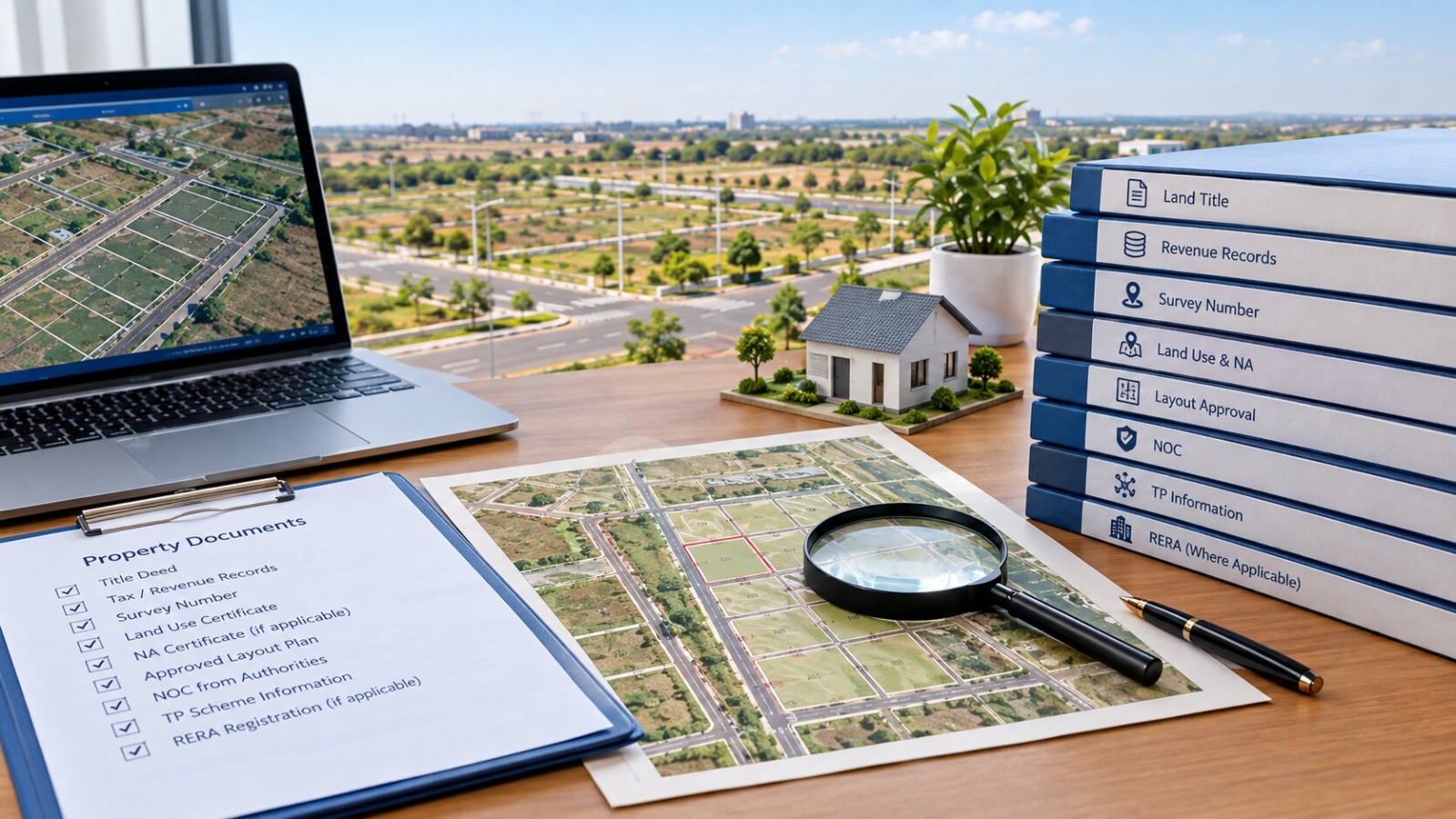
Buyers should verify ownership, land status, planning information, approvals, and documents relevant to the specific property. The exact requirements can differ according to the property's location and legal structure.
Common checks include the land title, revenue records, survey number, land-use status, NA documents where applicable, approved layout, NOC, TP information, and RERA status where applicable.
The survey number should match the property documents and actual location. Do not assume that one document proves every legal requirement. Title, land use, layout approval, and project compliance are separate matters.
For instance, an investor can find a property attractive on price but discover during verification that its documentation does not match the marketed layout. Independent legal verification is advisable before making a substantial payment.
Not every property marketed as a Dholera plot has the same relationship with Dholera SIR. Dholera SIR is a defined planned development region. Other properties may be located in surrounding areas and marketed using the broader Dholera name.
That distinction does not automatically make an outside-SIR property unsuitable. However, buyers should verify the exact village, survey number, land-use status, permissions, road access, and development position.
For example, two projects may both advertise themselves as being in Dholera. One may fall within the SIR planning framework, while another may sit outside it. NICDC identifies DSIR as a 920 sq. km. planned development region with a 22.54 sq. km. Activation Area.
Therefore, investors should verify the property's exact position rather than judging it by its marketing name.
Dholera Smart City photos can show general development, but they cannot prove a particular plot's location or legal status. Online photos can help investors understand roads, infrastructure, construction activity, industrial areas, and surrounding development.
However, a photograph does not prove that the same infrastructure exists directly beside the property being offered. During a site visit, check the approach road, surrounding construction, electricity infrastructure, drainage, nearby development, and actual distance from key locations. Match the physical site with the project layout and property documents.
For example, a road shown in dholera smart city photos may look close to a project on a brochure but require a different route when you visit the actual location.
NICDC states that trunk infrastructure is in place across the Activation Area. Seeing the site yourself helps separate existing development from future expectations.
A good comparison considers location, documentation, infrastructure, accessibility, development stage, and total cost together. Investors should also consider their holding period and expected exit route. A plot intended for long-term investment may suit a different buyer than one intended for near-term resale or construction.
For example, a buyer with a ten-year horizon may evaluate planned infrastructure differently from someone seeking immediate rental income. Dholera's industrial and infrastructure development creates a long-term investment narrative, but future appreciation should never be treated as guaranteed. The practical approach is to compare what exists today with what is officially planned. That gives the investor a clearer basis for judging the asking price.
Three checks should guide your Dholera property decision.
Check the survey number, TP scheme, road access, land-use status, and distance from developed infrastructure. Dholera SIR covers 920 sq. km., so location differences can matter significantly.
Review the land title, revenue records, applicable NA documents, NOC, approved layout, TP information, and RERA status where applicable. Independent legal advice can help before payment.
The 22.54 sq. km. Activation Area has trunk infrastructure in place, according to NICDC.
These points give investors a practical way to compare properties. Instead of asking only whether a plot is cheap, ask what location, documentation, accessibility, and existing infrastructure you receive for the total price.
Get information on various plots at affordable prices from Vishall Landbase.
Explore Investment OpportunitiesA plot in Dholera Smart City generally means land offered for residential, commercial, or another permitted use within or around the Dholera development region. Buyers should verify the exact dholera smart city location, land-use status, ownership documents, TP position, and development status before purchasing.
Verify the location, documents, infrastructure, and total cost before choosing your Dholera property. A plot in Dholera Smart City can suit investors seeking long-term exposure to Dholera's planned development — but the difference between a good and poor investment often comes down to the checks you perform before payment, not the brochure you were shown.
Get information on various plots at affordable prices from Vishall Landbase.
Contact Us Today